
Tampa Bay Weather Update: Rain on the Way
All right, my friends, we have some rain on the way for the Sunshine State. We have some chances to talk about on Sunday and then yet another impactful system on the way for Tuesday into Wednesday. That storm is going to be packing quite a punch across the Deep South where we are talking snow, ice, and rain for us.
Weekend Weather Overview
Let’s start with the weekend. Today we’re talking mostly cloudy, a bit breezy but mild temperatures. The brunt of the rain and storms doesn’t move through until early tomorrow. By Sunday morning, it’s heaviest for our northern spots as that kind of front expands the rain and storms through the morning and afternoon across the area.
Cold Air Moves In
Monday, the cold air moves in. The clouds will stay with us, but we dry things out for our MLK day as that’s kind of the in-between transition day. We’ll call it between our Sunday system and another impactful one moving through Tuesday into Wednesday.
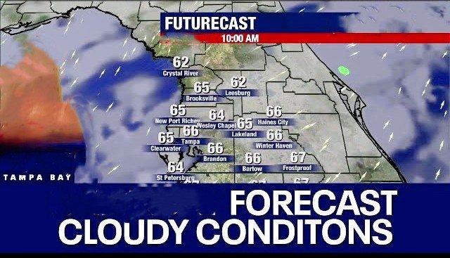
Today’s Temperature Outlook of Tampa Bay
Looking at your day planner for today, temperatures will be in the low 60s for many spots with upper 50s mixed in. It’s comfortable out there right now. We have light winds coming in out of the south, and we’re actually going to be talking about a bit of a breeze picking up later today. Winds will be coming in out of the north for tomorrow.
Warming Through the Morning
Through the morning hours, we’ll slowly warm into the low 70s, and by around noon in the early afternoon hours, we start to warm into the low 70s. Mostly cloudy skies will continue to stay with us, and some spots may top out in the upper 60s, just shy of 70 degrees. Rain chances are minimal today with a couple of spotty showers expected, mainly to the north of Tampa Bay.
Rain Chances Increasing Tonight
We start to see that boundary of increase for some of our Bay or Nature Coast spots getting into the late-night hours tonight. That’s when we have a better chance for a sprinkle here or there. On the back side of the day today, maybe as some of us are making our way home from the parade, we’ll talk about an isolated shower or two, but nothing too heavy or significant.
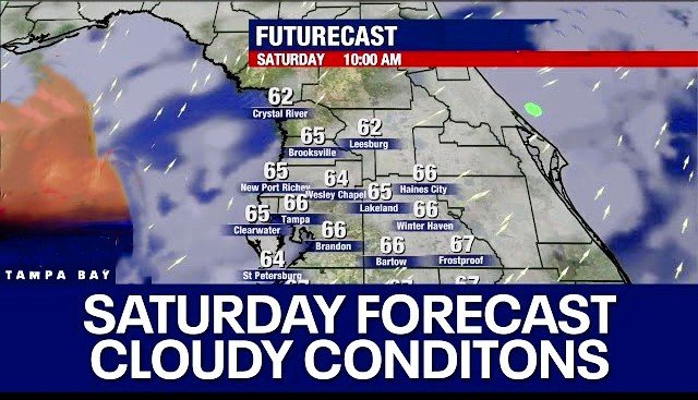
Sunday’s Rain and Winds
By early tomorrow, that will start to pick up, and through the day, we’ll be talking about those downpours starting first thing in the morning and then clearing for the late afternoon and evening hours. Winds will be active, with the potential for 10 to 15 mph winds later today and through Sunday, starting with a south wind and then shifting to the north by tomorrow afternoon as that front pulls through.
Cold Weather on the Horizon
Today, heavy rain is possible with some storms mixed in tomorrow. Then much colder air will move in, making things very active for much of the country with another impactful blast of Arctic air pushing south from Canada. This will mean subzero temperatures for much of the country next week.
Chilly Week Ahead
For Tampa Bay, it will be cold, with highs likely staying in the 50s for several days. Looking ahead to MLK day, then Tuesday and Wednesday, and even through the end of the week, we’ll still be in that chilly range before temperatures return to the 70s, likely not until Monday the 27th. Wrapping up January, there will be more warmth in store.
Watching Tuesday’s Storm
We’ll be closely watching the Tuesday storm. Snow is expected to move into the Gulf Coast, with icy conditions indicated by the pink color on the forecast model. While Tampa Bay will remain on the rainy side, parts of North Florida on Wednesday morning could see snow and ice conditions.
Final Thoughts
This will be a very impactful storm moving across the Deep South. We’ll continue to monitor and provide updates. For today, plan on low 70s, and tonight will still be mild, with temperatures bottoming out in the 60s across the area. On Sunday, it will be relatively comfortable, right around 70°F, before the cold air moves in with a high of 54°F on Monday.